Uganda is situated with in the great lakes’ region of Africa. The landscape of Uganda is blessed with about 165 lakes including fresh water lakes, crater lakes and others. Here is the list of some the most famous lakes in Uganda.
Lake Bunyonyi

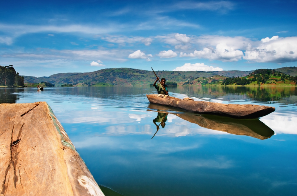
Lake Bunyonyi is one of the smallest lakes in Uganda and it is found in the south western part of Uganda between Kabale district and Kisoro district near the border of Rwanda and Uganda. Lake Bunyonyi stretches about 25km in length and 7km in width while the depth is anticipated to be around 44m. The lake is among is among the most beloved destination to visit in the pearl of Africa due to its natural setup such as the green terraced height that reaches a height of about 2,478m. The most spectacular scenery of this Lake is the presence of the 29 islands of various area sizes that are scattered all over the waters of Bunyonyi. In the morning, the atmosphere is filled with cotton-like streams of mist and in the afternoon get to have a warm glow of the sun. The lake is commonly known as a place of many little birds is one of the peaceful, loveliest and magical lakes in Uganda. Lake Bunyonyi attracts a lot of visitors all over the world especially the bird lovers and clear waters that are free from crocodile and hippo which enables travellers to swim. Lake Bunyonyi’s boat cruises are adventurous and give you the perfect view of the site.
Lake Victoria

Lake Victoria is one of the African great lakes with a surface area of approximately 59,947km2. Lake Victoria is Africa’s largest lake by area, the world’s largest tropical lake, and the world’s second largest fresh water lake by surface area after Lake Superior in North America. In terms of volume, Lake Victoria is the world’s ninth largest continental lake, containing about 2,424km3 of water. Lake Victoria occupies a shallow depression in Africa. The lake has an average depth of 40m and maximum depth of 80-81m. Its catchment area covers 169,858km2. The lake’s area is divided among three countries Tanzania occupies 49% (33,700km2), Uganda 45% (31, 000km2) and Kenya 6% (4,100km2). Lake Victoria was named after the Queen of England Victoria and its among the Victorian features in Uganda. It was found by one of the England early explores called John Hanning Speke, who therefore named it Lake Victoria.
Lake Mutanda

The lake is located in Kisoro district in southwestern Uganda, approximately 20km north of Kisoro, where the district headquarters are located. This location is approximately 454km, by road, southwest of Kampala, Uganda’s capital and largest city. It is nestled in the foothills of the Viruga Mountain range, at an altitude of 1,800 metres (5,900ft). The three volcanoes within the range, that are partly located in Uganda, namely: Mount Muhabura, Mount Sabinyo and Mount Gahinga can be viewed from Lake Mutanda. There are several islands in the lake. The lake is drained by the Rutshuru River, which flows northward to lake Edward. The environment on the islands within the lake and the surrounding countryside includes lakeside forests and wetland habitats that provide a haven for the endangered mountain gorilla. The lake shores i also a home to a variety of Amphibian species including snake, chameleon, monitor lizard and frogs. There is a varied and abundant supply of insect life as well. The mammals found in lake Mutanda include the African clawless otter. Hippopotamus was also present in the area, but were last sighted at Lake Mutanda in 1994.
Lake Mburo

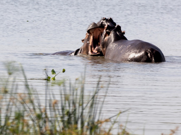
Lake Mburo is a lake as well as a national park a compact gem, located conveniently close to the highway that connects Kampala to the parks of western Uganda. It is the smallest of Uganda’s savannah national parks and underlain by ancient Precambrian metamorphic rocks which date back more than 500 million years. It’s a home to 350 bird species as well as zebras, impalas, elands, buffalos, oribi, Defassa waterbuck, leopard, hippo, hyena, Topi and reedbuck. Together with 13 other lakes in the area, Lake Mburo forms part of a 50km-long wetland system linked by a swamp. Five of these lakes lie within the park’s borders. Once covered by open savanna, this supports the healthy population of Buffalos, Warthogs, bushpig and hippopotamus. Lake Mburo National Park now contains much woodland as there are no elephants to tame the vegetation. In the western part of the park, the savanna is interspersed with rocky ridges and forested gorges while patches of papyrus swamp and narrow bands of lush riparian woodland line many lakes. Lake Mburo is notably blessed with over 315 bird species and probably the best place to view acacia-associated birds, Rwonyo is a good zone to see the mosque swallow, black bellied bustard, bare-faced-go away bird and Ruppell’s starling. A handful of birds is recorded essentially the southern ground hornbill and black throated barbet.
Lake Edward

Lake Edward is one of the smaller African great lakes. It is located in the Albertine rift, the western branch of the East African rift, on the border between the Democratic republic of Congo and Uganda, with its northern shore a few kilometres south of the equator. Lake Edward’s surface area of 2,325 km2 renders it the smallest of the East African Great lakes. The lake’s northern shore is just a few kilometres south of the Equator. Lake George drains into Lake Edward via the 32km long Kazinga channel, a major attraction within Queen Elizabeth national park. Although lake Edward’s name has changed several times, its majestic has remained constant. In 1888, the British explorer, Henry Morton Stanley, named the lake after Prince Albert Edward, the son of Queen Victoria. In 1973, the Ugandan dictator Idi Amin, named the Lake after himself. However, the original name was reinstated after Amin was overthrown in 1979. Like Lake George, lake Edward is designated as a Ramsar site due to the importance of its wetland habitat. The lake is inhabited by many fish species, include the Nile tilapia and the blue-spotted tilapia. Fishing is an important economic activity, and it provides an income for the local residents. Vitshumbi is the largest of the local fishing villages. The banks of lake Edward are home to elephants, Chimpanzees, buffaloes and crocodiles. Lake Edward is visited by many species of migratory water birds, and the lesser flamingo has been spotted several times.
Lake George
Lake George or Lake Katuguru is a lake in Uganda covering a total surface area of 250 square kilometres and is a part of the African Great Lakes system, although it is not considered one of the great lakes. Like the other lakes in the region, it was renamed after a member of the British royal family, in this case, Prince George, later to become king George V. Lake George drains to the southwest into Lake Edward through the Kazinga channel. The area surrounding the lake is populated by the Batooro, Basongora, Banyampaka and Banyankore peoples, among others. All these nations speak closely related dialects which are generally referred to as Runyakitara language. Akatunguru is a word which means ‘onion’ and is used by all these different peoples. Thus, the lake came to be known as Katunguru because of its onion-like shape. Welsh explorer Henry Morton Stanely was the first European to see the lake in 1875, after following the course of the Katonga River from Lake Victoria during his trans-African expedition. Thinking it was part of the Lake Albert; he renamed it Beatrice Gulf. Exploration plans were aborted because of the threat of conflict with the Kingdom of Bunyoro. On his second visit to the area, in 1888 during the Emin Pasha Relief Expedition, Stanley discovered Lake Edward, and realizing that there were two independent lakes, gave Lake George its current name.
Lake Albert
Lake Albert, originally known as Lake Mwitanzige by the Banyoro, Nam Ovoyo Bonyo by the Alur and temporarily as lake Mobutu Sese seko. It is Africa’s seventh-largest lake, as well as the second biggest of Uganda’s great lakes. Lake Albert is located on the border between Uganda and the Democratic Republic of the Congo. It is the northernmost of the chain of lakes in the Albertine rift, the western branch of the East African Rift. It is about 160km long and 30km across at its widest, with a maximum depth of 51 metres and a surface elevation of 619 metres above sea level. Lake Albert is part of the complicated system of the upper Nile. Its main source is the White Nile, ultimately coming from Lake Victoria to the southeast and the Semliki River, which issues from Lake Edward to the southwest. The water of the Victoria Nile is much less saline than that of Lake Albert. The lake’s outlet, at its northernmost tip, is the Albert Nile section of the White Nile. The river later become know as the Mountain Nile when its course enters South Sudan. At the southern end of the lake, where the Semliki comes in, there are swamps. The Rwenzori Mountains are to the south of the lake and to the northwest, the Blue Mountains. The few settlements along the shore include Butiaba and Pakwach. Lake Albert is a home to many aquatic and semi-aquatic animals like hippopotamuses, Uganda Kob antelopes, Nile crocodiles, Nile monitors, African softshell turtles, central African mud turtles, William’s mud turtles, various semi-aquatic snakes and various frogs. Water birds are numerous and include pelicans, herons and the rare shoebill.
Lake Kyoga

Lake Kyoga or lake Kioga is a shallow lake in Uganda about 1,720km2 in area and at elevation of 1,033 metres. The Victoria Nile flows through the lake on its way from Lake Victoria to lake Albert. The main inflow from Lake Victoria is regulated by the Nalubaale power station in Jinja. Another source of water is the Mount Elgon region on the border between Uganda and Kenya. While lake Kyoga is part of the African great lakes system, it is not itself considered a great lake. The lake is located in central Uganda. The lake is separated into three sections: the open water is deeper than 3m, the shallow water is covered by water lilies, and the swampy shoreline is almost completely covered by papyrus and the invasive water hyacinth. Lake Kyoga contains 46 fish species and the majority are endemic. However, many of lake Kyoga’s endemic species are closely related to species that found in Lake Victoria.
Like Lake Victoria, lake Kyoga has experienced a loss in biodiversity since the introduction of the Nile perch in the 1950s. Lake Kyoga is also a home to the Nile crocodile, which can reach up to 5m in length. Fishing and birding are also popular activities at lake Kyoga. The lake is a home to several rare bird species, including the fox’s weaver.
Lake Katwe

Lake Katwe is found within an explosion crater in the formerly active volcanic area. This is northern of lake Edward and southeast of lake George. The lake is found in the small run-down town of Katwe on the outskirts of the queen Elizabeth national park in the Kasese district. It covers an area of approximately 8sqmi. Its shores are lined with small ponds or pans of water from which salt is extracted from bottom in a process called salt mining. The lake is believed to have been formed more than 10,000 years ago as a result of volcanicity. The famous area in Queen Elizabeth national park has recently become a vibrant tourist attraction to learn about salt mining and visit the local community within its neighbourhood.
Lake Katwe is known for its substantial salt production and has been producing high quality salt for many years. The water in this lake is 60% salty because the region is semi-arid and the soil doesn’t Favor agricultural activities. Therefore, the major economic activity here is salt mining and fishing in the nearby lake Edward and George. Salt has extracted from this lake since the 13th century.
Lake Nkugute

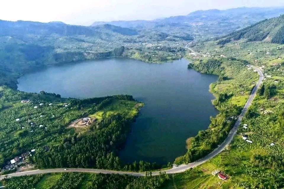
Lake Nkugute also known as lake Rutoto is a lake located in Rubirizi district, Uganda. Situated in the Bunyarunguru volcanic field, the lake is believed to have been formed over 12,000 years ago as a result of volcanicity. It has become a place of mystery and local folklore, with tales surrounding its origin and behaviour. Lake Nkugute has an estimated terrain elevation above sea level of 4645ft. It is shaped in a manner that resembles the map of Africa, leading some locals to refer to it as “lake Africa.” The lake’s boundaries can be observed from a hill that borders it. Lake Nkugute has become a popular destination for tourists, though the local community has had limited benefits from the tourism industry. Tourists often visit to capture the unique shape of the lake and its surrounding scenery. However, the absence of hotels or suitable accommodations in the area has hindered the local community’s ability to fully capitalize on tourism.
Efforts have been made to preserve the lake’s cleanliness and protect its resources, local authorities have banned activities such as washing clothes and cars in the lake to ensure the water remains clean. Fishing is not prevalent due the lack of fish. The residents of Bunyaruguru, particularly the Banyaruguru tribe, consider lake Nkugute to be an important part of their heritage. The Banyaruguru people have maintained strong ties to their Baganda origin and their traditional customs and practices are influenced by both Baganda and Kinyankole cultures
Lake Wamala

Lake Wamala is a freshwater lake in Uganda, its wetlands contain endangered species of birds and animals including the sitatunga. The lake is of traditional and cultural significance to the people of Buganda in central Uganda. The lake is shared by the districts of Kassanda, Mityana and Gomba in the Buganda region of Uganda. The road distance between downtown Mityana and Kalyan Koko, Kimuli, Mityana district, on the eastern shores of lake Wamala is approximately 17km. Lake Wamala covers an area of approximately 250 square kilometres. It is dotted by many islands, including Mabo Island, Lwanju island and Bagwe island among others. several rivers flow into the lake including River Nyanzi, River Kitenga, River Kaabasuma, River Mpamujugu and River Bbimbye. Lake Wamala is of significant economic and cultural interest locally and is jointly administered by the districts of Mubende, Mityana and Mpigi each of which share a part of the lake along common borders.
More than 4,000 years ago lake Wamala was part of Lake Victoria, but has since receded into its current state. One apocryphal myth supposes that lake Wamala derives its name from a king Wamala, the last monarch of the Bachwezi dynasty and that king Wamala disappeared into the lake at a site near Lubajja fishing village called Nakyegalika and his spirit resides in the lake. The vegetation surrounding lake Wamala is dominated by papyrus. Other floaters and water-based vegetation. There are also trees such as Raphia and other palms. A variety of animal species such as sitatunga, wild pigs, hippopotamus, bushbuck, waterbuck, vervet monkey, baboon, guinea fowl and turaco live near the lake. Existing fish species include tilapia, catfish and lungfish


